Current Mountain Snow and Weather Conditions:


Apex Mountain
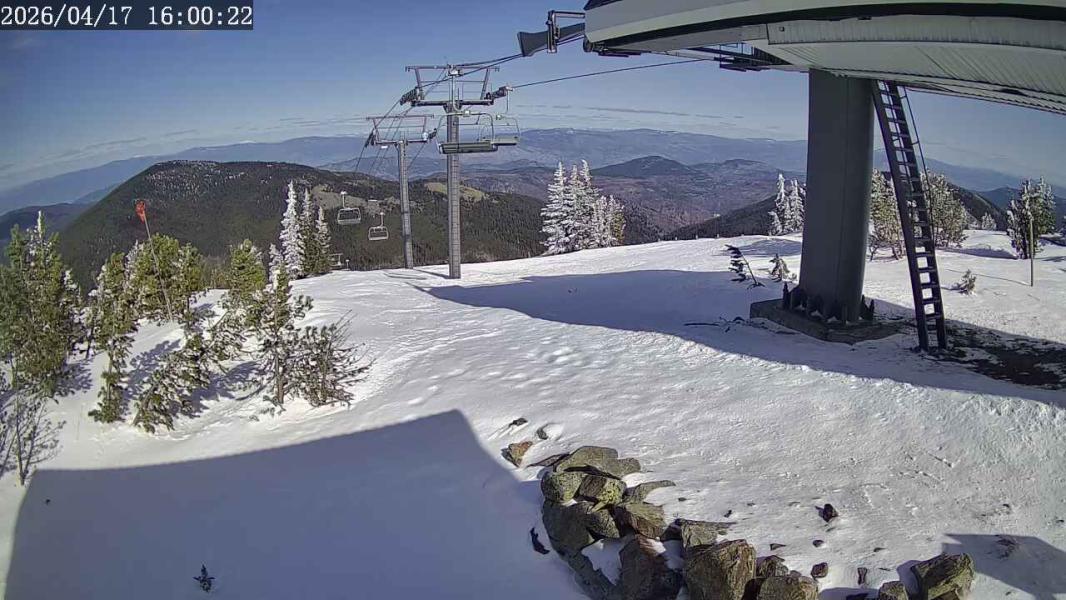
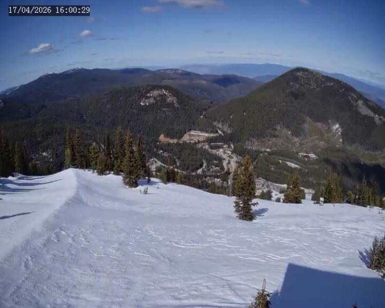
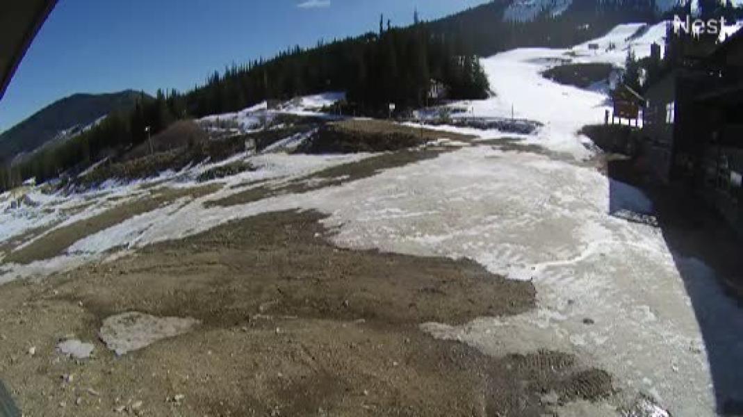
Webcams
Last 24 Hrs:

OK_Run
Not Available
Old_Mill
Not Available
EasyRider
Not Available


Forecast


GFS Forecast Updated:  
10 Day snow total
10 day rain total
24 Hour Snow total
GFS Elevation
top/bottom
Location:
Mar 25, 2025: 12pm
42.4 cm
5.3 mm
0 cm
1595 m
1570-2181m
apex
 
                     ― High Clouds ― Mid Clouds ― Low Clouds ― Surface Gusts(Km/Hr) ― 1800m Wind Speed (Km/Hr), Direction

F (Standard)
C (Metric)


Avalanche Bulletin

Granby
Issued by: avalanche-canada
Issued at: Tue Mar 25, 2025 16:00 PST
Valid Until Wed Mar 26, 2025 16:00 PST
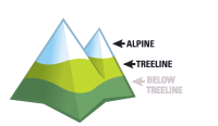
Danger ratingsProblemsDetails

If the sun comes out and the wind is calm, expect avalanche danger to rise rapidly.
Avoid being on or underneath slopes in the sun. High north slopes may hold dry snow.
WednesdayThursdayFriday
AlpineConsiderableConsiderableModerate
TreelineConsiderableConsiderableModerate
Below TreelineConsiderableConsiderableModerate

Terrain and Travel Advice:
  • Avoid sun-exposed slopes, especially if the snow surface is moist or wet.
  • A moist or wet snow surface, pinwheeling, and natural avalanches are all indicators of a weakening snowpack.
  • Pay attention to cornices and give them a wide berth when traveling on or below ridges.
Wet Slab

Rising temperatures, rain, and sun contribute to wet slabs being possible. High elevation north facing terrain may hide dry snow.

Wet Loose

Wet loose avalanches are expected to occur, especially on slopes in the sun.

Cornice cornice

Cornices may fail naturally during warm sunny weather.

Avalanche Summary

On Monday, a few small storm slabs and wet loose avalanches were triggered with explosives near Vernon.

On the weekend, there were numerous small storm slabs triggered by riders.

As temperatures rise, wet avalanches are expected to occur and cornices may fall, especially when the sun comes out.

Snowpack Summary

As temperatures rise to above mountain top, the recent snow (around 40 cm) is expected to become moist and wet.

Otherwise, a melt-freeze crust is 40 to 70 cm deep from early march. Below that, two weak layers of surface hoar and/or faceted grains associated with crusts from late-January and mid-February may be found 70 to 120 cm deep.

The mid and lower snowpack is well-settled and strong.

Weather Summary

Tuesday Night

Cloudy. 20 to 30 km/h southwest ridgetop wind. Treeline temperature 3 °C. Freezing level 2800 m.

Wednesday

A mix of sun and cloud, with 2 mm of rain in the afternoon. 10 to 20 km/h south ridgetop wind. Treeline temperature 6 °C. Freezing level 3000 m.

Thursday

Mostly cloudy with 5 to 15 cm/mm of snow or rain. 20 to 30 km/h south ridgetop winds. Treeline temperature 0 °C. Freezing level falling to 1800 m by noon.

Friday

Mostly cloudy with 5 cm of snow. 30 to 40 km/h southeast ridgetop winds. Treeline temperature 0 °C. Freezing level 2000 m.

More details can be found in the Mountain Weather Forecast.

Confidence: moderate
We are confident the likelihood of avalanche will increase with the arrival of the forecast weather.
Coquihalla
Issued by: avalanche-canada
Issued at: Tue Mar 25, 2025 16:00 PST
Valid Until Wed Mar 26, 2025 16:00 PST
Danger ratingsProblemsDetails

Avoid all avalanche terrain during periods of high hazard.
Rain and high freezing levels can trigger avalanches on buried weak layers.
WednesdayThursdayFriday
AlpineHighConsiderableConsiderable
TreelineConsiderableConsiderableConsiderable
Below TreelineConsiderableModerateModerate

Terrain and Travel Advice:
  • Avoid exposure to overhead avalanche terrain; avalanches may run surprisingly far.
  • Loose avalanches may step down to deeper layers, resulting in larger avalanches.
  • Keep in mind that the high density of wet avalanches can make them destructive.
Wet Slab

Rain and 3000 m freezing levels will destabilize the surface snow, making wet loose, and wet slab avalanches where storm slabs previously existed.

Persistent Slab

A weak layer from January, consisting of a melt-freeze crust with facets, is being tested by heavy loads from snow, rain, and warming. This layer could be a concern in the south and east ends of the region in shallower snowpack areas.

Avalanche Summary

On Monday, numerous natural wet loose avalanches up to size 2 were reported in the southern part of the region. Check out this MIN report for more details.

We expect a natural avalanche cycle to continue with rain and warm temperatures destabilizing the snowpack.

Thank you for sharing your observations to the MIN.

Snowpack Summary

10 mm of rain is expected to create moist surfaces on all aspects and elevations. This falls on 40 to 60 cm of settling storm snow which was redistributed into deeper deposits on north- and east-facing slopes by strong southwest winds. This sits atop 80 to 100 cm of settled snow on north-facing slopes, and several thin melt-freeze layers on south-facing slopes.

A supportive crust is found below this, on all aspects except on high, north-facing alpine terrain. Snow is reportedly bonded well to it.

A weak layer of facets and surface hoar from February is now 90 to 150 cm deep and a layer of facets and surface hoar from late January is 110 to 190 cm deep. Some recent planar results were reported in the Manning Park area.

Weather Summary

Tuesday Night

Cloudy. 15 to 45 km/h south ridgetop winds. Treeline temperature 5 °C. Freezing level 1300 m.

Wednesday

Mostly cloudy with light rain. 15 to 20 km/h south ridgetop winds. Treeline temperature 10 °C. Freezing level rises to 3200 m.

Thursday

Cloudy with wet snow 5 to 10 cm above 1800 m. 15 to 50 km/h south ridgetop winds. Treeline temperature 4 °C.

Friday

Cloudy with snow 5 to 10 cm above 1500 m. 15 gusting to 65 km/h southeast ridgetop winds. Treeline temperature 4 °C.

More details can be found in the Mountain Weather Forecast.

Confidence: moderate
We are confident the likelihood of avalanche will increase with the arrival of the forecast weather.
Uncertainty is due to the limited number of field observations.
Revelstoke
Issued by: avalanche-canada
Issued at: Tue Mar 25, 2025 16:00 PST
Valid Until Wed Mar 26, 2025 16:00 PST
Danger ratingsProblemsDetails

Avoid all avalanche terrain.
Large avalanches may run into the valley bottom from the alpine.

WednesdayThursdayFriday
AlpineHighConsiderableConsiderable
TreelineHighConsiderableConsiderable
Below TreelineHighConsiderableModerate

Terrain and Travel Advice:
  • Only the most simple non-avalanche terrain with no overhead hazard is appropriate at this time.
  • Even brief periods of direct sun could produce natural avalanches.
  • Storm slab size and sensitivity to triggering will likely increase through the day.
  • Avoid the runout zones of avalanche paths. Avalanches could run full path.
Persistent Slab

Persistent weak layers are overloaded and primed for triggering, and natural failure.

Storm Slab

Storm slabs, both wet and dry, may fail with high temperatures and solar input. They may step down to deeper weak layers.

Wet Loose

Wet loose avalanches are likely with high temperatures and potential sun. Avoid being on or underneath slopes in the sun.

Avalanche Summary

A large avalanche cycle occurred on Monday and likely into Tuesday. With many storm slabs stepping down to deep weak layers, causing very large avalanches, up to size 4.

In the southeast of the region on Monday, there was a fatal avalanche incident. A group was hit by a large (size 3) natural persistent slab avalanche.

Snowpack Summary

Up to 50 cm of recent snow is rapidly warming and expected to see the sun for the first time. The upper snowpack is expected to become moist and wet.

There is a significant concern for avalanches in motion to step down to deeper, persistent weak layers. These consist of surface hoar, facets, or a crust:

  • Early-March layer down 80–120 cm. This is the primary persistent layer of concern.

  • Mid-February & Late-January layers down 100–200 cm. Warm temperatures and sunshine may trigger these deep layers. Likewise, large triggers, like cornice fall or avalanches in motion, could step down.

Weather Summary

Tuesday Night

Cloudy with 0 to 10 mm/cm of rain/snow. 20 to 40 km/h southwest ridgetop wind. Treeline temperature 0 °C. Freezing level 2400 m.

Wednesday

A mix of sun and cloud. 20 to 30 km/h southwest ridgetop wind. Treeline temperature 3 °C. Freezing level 3000 m.

Thursday

Cloudy with 10 to 30 mm/cm of rain/snow. 20 km/h southwest ridgetop wind. Treeline temperature 0 °C. Freezing level falling to 2000 m.

Friday

Mostly cloudy with 5 to 15 mm/cm of rain/snow. 10 to 20 km/h southeast ridgetop wind. Treeline temperature -2 °C. Freezing level 1800 m.

More details can be found in the Mountain Weather Forecast.

Confidence: high
We are confident the snowpack will rapidly lose strength with the arrival of the forecast weather.


↓ - Penticton Forecast

Tuesday nightPartly cloudy. Fog patches developing after midnight. Wind north 20 km/h becoming light this evening. Low plus 3.
WednesdayA mix of sun and cloud. 60 percent chance of showers in the afternoon. Risk of thunderstorms and hail in the afternoon. Fog patches dissipating in the morning. High 13 except 16 near Osoyoos. UV index 4 or moderate.
Wednesday nightPartly cloudy. Becoming cloudy near midnight with showers. Snow level lowering to 1500 metres before morning. Amount 5 to 10 mm. Low 6.
ThursdayCloudy with 60 percent chance of showers. High 13.
Thursday nightCloudy. Low plus 3.
FridayPeriods of rain. High 11.
Friday nightCloudy with 60 percent chance of showers. Low plus 4.
SaturdayA mix of sun and cloud. High 12.
Saturday nightCloudy with 30 percent chance of showers. Low plus 3.
SundayCloudy. High 15.
Sunday nightCloudy. Low plus 4.
MondayCloudy. High 14.

↓ - Summerland Forecast

Tuesday nightPartly cloudy. Fog patches developing after midnight. Wind north 20 km/h becoming light this evening. Low plus 3.
WednesdayA mix of sun and cloud. 60 percent chance of showers in the afternoon. Risk of thunderstorms and hail in the afternoon. Fog patches dissipating in the morning. High 13 except 16 near Osoyoos. UV index 4 or moderate.
Wednesday nightPartly cloudy. Becoming cloudy near midnight with showers. Snow level lowering to 1500 metres before morning. Amount 5 to 10 mm. Low 6.
ThursdayCloudy with 60 percent chance of showers. High 13.
Thursday nightCloudy. Low plus 3.
FridayPeriods of rain. High 11.
Friday nightCloudy with 60 percent chance of showers. Low plus 4.
SaturdayA mix of sun and cloud. High 12.
Saturday nightCloudy with 30 percent chance of showers. Low plus 3.
SundayCloudy. High 15.
Sunday nightCloudy. Low plus 4.
MondayCloudy. High 14.

↓ - Kelowna Forecast

Tuesday nightMainly cloudy. Fog patches developing after midnight. Low 6.
WednesdayA mix of sun and cloud. Becoming cloudy in the afternoon with 60 percent chance of showers later in the afternoon. Risk of thunderstorms and hail in the afternoon. Fog patches dissipating in the morning. High 18. UV index 3 or moderate.
Wednesday nightShowers. Risk of thunderstorms early in the evening. Snow level lowering to 1500 metres before morning. Amount 5 to 10 mm. Low 9.
ThursdayCloudy with 60 percent chance of showers. High 13.
Thursday nightCloudy. Low plus 3.
FridayPeriods of rain. High 11.
Friday nightCloudy with 60 percent chance of showers. Low plus 4.
SaturdayA mix of sun and cloud. High 12.
Saturday nightCloudy with 30 percent chance of showers. Low plus 3.
SundayCloudy. High 15.
Sunday nightCloudy. Low plus 4.
MondayCloudy. High 14.

↓ - Princeton Forecast

Tuesday nightPartly cloudy. Fog patches developing after midnight. Wind southwest 20 km/h becoming light this evening. Low plus 5.
WednesdayA mix of sun and cloud. 60 percent chance of showers in the afternoon. Risk of thunderstorms and hail in the afternoon. Fog patches dissipating in the morning. High 18. UV index 4 or moderate.
Wednesday nightPartly cloudy. Becoming cloudy near midnight with showers. Low plus 5.
ThursdayA mix of sun and cloud with 40 percent chance of showers. High 13.
Thursday nightCloudy periods. Low zero.
FridayShowers. High 13.
Friday nightCloudy with 40 percent chance of showers. Low minus 4.
SaturdaySunny. High 11.
Saturday nightCloudy periods. Low plus 4.
SundayA mix of sun and cloud. High 15.
Sunday nightCloudy periods with 30 percent chance of showers. Low plus 5.
MondayCloudy with 60 percent chance of showers. High 13.

↓ - Vernon Forecast

Tuesday nightMainly cloudy. Fog patches developing after midnight. Low 6.
WednesdayA mix of sun and cloud. 60 percent chance of showers in the afternoon. Risk of thunderstorms and hail in the afternoon. Fog patches dissipating in the morning. High 16. UV index 3 or moderate.
Wednesday nightMainly cloudy. 60 percent chance of showers early in the evening. Showers beginning after midnight. Risk of thunderstorms early in the evening. Snow level lowering to 1500 metres before morning. Amount 5 to 10 mm. Low 9.
ThursdayCloudy with 60 percent chance of showers. High 13.
Thursday nightCloudy. Low plus 3.
FridayPeriods of rain. High 11.
Friday nightCloudy with 60 percent chance of showers. Low plus 4.
SaturdayA mix of sun and cloud. High 12.
Saturday nightCloudy with 30 percent chance of showers. Low plus 3.
SundayCloudy. High 15.
Sunday nightCloudy. Low plus 4.
MondayCloudy. High 14.

↓ - Western Satelite Loop

Satelite Loading


History


Load 7 Day Weather History
Current Weather:
ApexRoadside
1875m
BlackwallPeak
1940m
Temperature(C) 7.9 OUT OF DATE
Liq Precip Last 24Hr mm Last Reading At
Snow Depth72 cm2024-5-28 12:00
Wind


Locations

BC: Whistler Blackcomb
BC: Apex Mountain
BC: Fernie
BC: Mt Cain
BC: Cypress Mountain
BC: Mount Seymour
BC: Grouse Mountain
AB: Lake Louise Ski Resort
BC: Kicking Horse
BC: Revelstoke Mountain Resort
Ca: Heavenly
Ca: Diamond Peak
Ca: Mammoth Mtn
Ca: Kirkwood
Ca: Northstar at Tahoe
Ca: Sierra at Tahoe
Ca: Squaw Valley
Co: Crested Butte
Co: Aspen Mountain
Co: Aspen Highlands
Co: Buttermilk
Co: Snowmass
Co: Beaver Creek
Co: Breckenridge Resort
Co: Keystone Resort
Co: Telluride
Co: Vail Resort
Or: Mt Hood Meadows
Ut: Brighton
Ut: Solitude
Ut: Snowbird
Ut: Park City Mountain Resort
Wa: Mount Baker
Wa: Crystal Mountain
Wa: Stevens Pass
Wy: Jackson Hole


**This page is for informational purposes only and is not intended as a guide or gurantee of weather or conditions accuracy. Use with good judgement and explore with caution**
------------- Contact/DM -------------