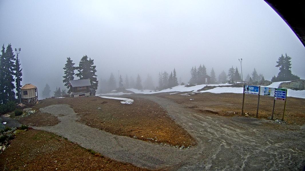
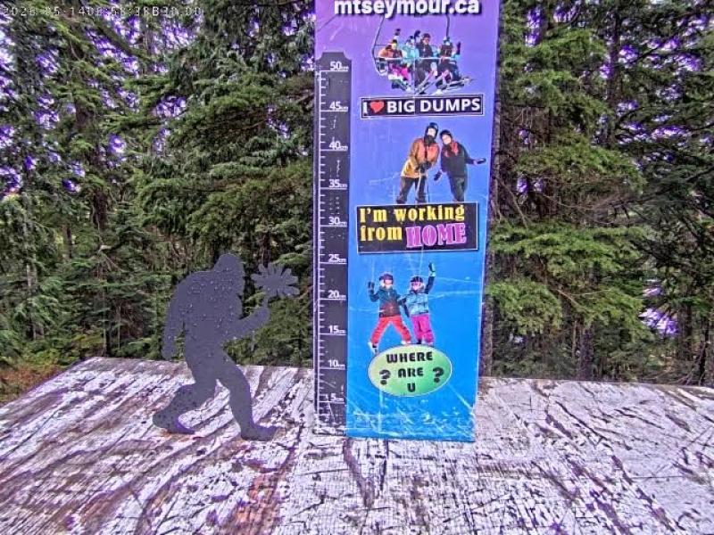
Current Mountain Snow and Weather Conditions:


Mount Seymour
Webcams
Last 24 Hrs:

Base
Not Available
Ironworkers_South
Not Available
Seymour_Pkwy
Not Available

Seymour Live Streams

Mount Seymour Snowfall and Temperature History


Weather

Currently:
Temp(C)24 hr Snow(cm)Runs Open Base Depth(cm)
7.00.027258


Forecast


GFS Forecast Updated:  
10 Day snow total
10 day rain total
24 Hour Snow total
GFS Elevation
top/bottom
Location:
Mar 25, 2025: 12pm
36.2 cm
121.7 mm
0 cm
836 m
936-1265m
seymour
 
                     ― High Clouds ― Mid Clouds ― Low Clouds ― Surface Gusts(Km/Hr) ― 1800m Wind Speed (Km/Hr), Direction

F (Standard)
C (Metric)


Avalanche Bulletin

North Shore
Issued by: avalanche-canada
Issued at: Tue Mar 25, 2025 16:00 PST
Valid Until Wed Mar 26, 2025 16:00 PST
Danger ratingsProblemsDetails

Rain and warm temperatures make wet avalanches likely and will weaken looming cornices on ridgelines.
Warm, wet and sticky snow makes for less desirable travel conditions.
WednesdayThursdayFriday
AlpineConsiderableConsiderableConsiderable
TreelineConsiderableConsiderableConsiderable
Below TreelineConsiderableModerateModerate

Terrain and Travel Advice:
  • Keep in mind that the high density of wet avalanches can make them destructive.
  • A moist or wet snow surface, pinwheeling, and natural avalanches are all indicators of a weakening snowpack.
  • The more the snowpack warms up and weakens, the more conservative your terrain selection should be.
Wet Loose

Rain-on-snow and warm temperatures will rapidly destabilize the snowpack, with 3000 m freezing levels and up to 15 mm expected.

Wet Slab

Wet slab avalanches are large and destructive. Cornice failures could trigger them from the slope below.

Avalanche Summary

We expect avalanche activity to continue with rain-on-snow and warming. No new avalanche reports on Monday.

On Sunday several storm slab avalanches were reported, size 1 and 2. On Saturday at Grouse Mountain, numerous size 2 storm slabs were triggered remotely, up to 50 cm deep.

Thanks for sharing your observations to the MIN.

Snowpack Summary

5 to 15 mm of rain is expected to fall up to 2500 m. This falls on up to 50 cm of recent snow redistributed by southwest winds at upper elevations, and an already moist snowpack at lower elevations.

This overlies up to 1.5 m of previous settling storm snow, which was reportedly well-bonded to an underlying, supportive crust, that is now expected to be 180 to 250 cm deep.

Below this, the snowpack is well-settled and strong.

Weather Summary

Tuesday Night

Clear with some clouds. 15 to 45 km/h south ridgetop winds. Treeline temperature 10 °C. Freezing level 3000 m.

Wednesday

Mostly cloudy with rain 15 to 20 mm. 15 to 35 km/h south ridgetop winds. Treeline temperature 10 °C. Freezing level rises to 3000 m.

Thursday

Rain, 10 to 25 mm falling as snow above 1200 m. 30 to 50 km/h southeast ridgetop winds. Treeline temperature 2 °C.

Friday

Cloudy with 15 to 30 mm, falling as snow above 1200 m. 15 gusting to 60 km/h south ridgetop winds. Treeline temperature 3 °C.

More details can be found in the Mountain Weather Forecast.

Confidence: moderate
Uncertainty is due to the limited number of field observations.
Whistler
Issued by: avalanche-canada
Issued at: Tue Mar 25, 2025 16:00 PST
Valid Until Wed Mar 26, 2025 16:00 PST
Danger ratingsProblemsDetails

Avoid all avalanche terrain during periods of high hazard.
Rain and high freezing levels can trigger avalanches on buried weak layers.
WednesdayThursdayFriday
AlpineHighConsiderableConsiderable
TreelineHighConsiderableConsiderable
Below TreelineConsiderableConsiderableModerate

Terrain and Travel Advice:
  • Only the most simple non-avalanche terrain with no overhead hazard is appropriate at this time.
  • Be aware of the potential for large avalanches due to buried weak layers.
  • A moist or wet snow surface, pinwheeling, and natural avalanches are all indicators of a weakening snowpack.
  • Keep in mind that the high density of wet avalanches can make them destructive.
Persistent Slab

Weak layers can become reactive when loaded due to rain or warming.

A weak layer from early March is now 150 to 230 cm deep with January and February layers buried 200 to 300 cm. These remain a concern, especially in northerly alpine terrain.

Wet Slab

Rain-on-snow and warm temperatures can rapidly destabilize the snowpack.

Wet slab avalanches are large and destructive. Wet loose are seen from steep terrain features.

Storm Slab

Storm snow and moderate southwest winds has formed reactive slabs. Expect to find deeper deposits on north- and east-facing slopes at upper elevations, where the wind will load lee slopes.

Avalanche Summary

On Tuesday, numerous natural and explosive triggered wet slab avalanches were reported up to size 3.

On Monday, numerous large slab avalanches were seen up to size 2.5.

We expect avalanche activity to continue with both wet and large slab avalanches being easy to trigger during this warm period.

Snowpack Summary

We have received up to 30 mm of recent precipitation; snow above 1500 m and rain below this elevation. Expect deeper and more reactive deposits on north—and east-facing slopes. This overlies 40 cm of recent snow. Expect to find rain-soaked or moist snow below 1500 m.

This overlies 50 cm of settled snow and then a melt-freeze crust on southerly slopes and at lower elevations.

A weak layer formed in early March found down 150 to 230 cm, consists of a crust on all aspects except high north-facing slopes. In some areas, a layer of surface hoar is found just above the crust.

Weak layers formed in mid-February and late January are now buried 200 to 300 cm deep.

Below this, the snowpack is well-settled and strong.

Weather Summary

Tuesday Night

Cloudy. 15 to 45 km/h south ridgetop winds. Treeline temperature 6 °C. Freezing level 2500 m.

Wednesday

Mostly cloudy with sunny periods and light rain 5 mm. 15 to 35 km/h south ridgetop winds. Treeline temperature 9 °C. Freezing level rises to 3000 m.

Thursday

Wet flurries 5 to 10 cm above 1500 m falling as rain below. 15 to 35 km/h southeast ridgetop winds. Treeline temperature 2 °C.

Friday

Cloudy with a mix of rain and snow 10 to 15 cm. 15 gusting to 60 km/h south ridgetop winds. Treeline temperature 2 °C. Freezing level 1600 m.

More details can be found in the Mountain Weather Forecast.

Confidence: moderate
Uncertainty is due to the complexity of the snowpack’s structure.
We are confident the likelihood of avalanche will increase with the arrival of the forecast weather.
Coquihalla
Issued by: avalanche-canada
Issued at: Tue Mar 25, 2025 16:00 PST
Valid Until Wed Mar 26, 2025 16:00 PST
Danger ratingsProblemsDetails

Avoid all avalanche terrain during periods of high hazard.
Rain and high freezing levels can trigger avalanches on buried weak layers.
WednesdayThursdayFriday
AlpineHighConsiderableConsiderable
TreelineConsiderableConsiderableConsiderable
Below TreelineConsiderableModerateModerate

Terrain and Travel Advice:
  • Avoid exposure to overhead avalanche terrain; avalanches may run surprisingly far.
  • Loose avalanches may step down to deeper layers, resulting in larger avalanches.
  • Keep in mind that the high density of wet avalanches can make them destructive.
Wet Slab

Rain and 3000 m freezing levels will destabilize the surface snow, making wet loose, and wet slab avalanches where storm slabs previously existed.

Persistent Slab

A weak layer from January, consisting of a melt-freeze crust with facets, is being tested by heavy loads from snow, rain, and warming. This layer could be a concern in the south and east ends of the region in shallower snowpack areas.

Avalanche Summary

On Monday, numerous natural wet loose avalanches up to size 2 were reported in the southern part of the region. Check out this MIN report for more details.

We expect a natural avalanche cycle to continue with rain and warm temperatures destabilizing the snowpack.

Thank you for sharing your observations to the MIN.

Snowpack Summary

10 mm of rain is expected to create moist surfaces on all aspects and elevations. This falls on 40 to 60 cm of settling storm snow which was redistributed into deeper deposits on north- and east-facing slopes by strong southwest winds. This sits atop 80 to 100 cm of settled snow on north-facing slopes, and several thin melt-freeze layers on south-facing slopes.

A supportive crust is found below this, on all aspects except on high, north-facing alpine terrain. Snow is reportedly bonded well to it.

A weak layer of facets and surface hoar from February is now 90 to 150 cm deep and a layer of facets and surface hoar from late January is 110 to 190 cm deep. Some recent planar results were reported in the Manning Park area.

Weather Summary

Tuesday Night

Cloudy. 15 to 45 km/h south ridgetop winds. Treeline temperature 5 °C. Freezing level 1300 m.

Wednesday

Mostly cloudy with light rain. 15 to 20 km/h south ridgetop winds. Treeline temperature 10 °C. Freezing level rises to 3200 m.

Thursday

Cloudy with wet snow 5 to 10 cm above 1800 m. 15 to 50 km/h south ridgetop winds. Treeline temperature 4 °C.

Friday

Cloudy with snow 5 to 10 cm above 1500 m. 15 gusting to 65 km/h southeast ridgetop winds. Treeline temperature 4 °C.

More details can be found in the Mountain Weather Forecast.

Confidence: moderate
We are confident the likelihood of avalanche will increase with the arrival of the forecast weather.
Uncertainty is due to the limited number of field observations.


↓ - West Vancouver Forecast

Tuesday nightPartly cloudy. Fog patches developing overnight. Low 8.
WednesdayA mix of sun and cloud. 40 percent chance of showers in the afternoon. Risk of a thunderstorm and hail in the afternoon. Fog patches dissipating in the morning. High 16 except 19 inland. UV index 3 or moderate.
Wednesday nightCloudy. Showers at times heavy beginning in the evening. Amount 15 to 25 mm. Wind northwest 20 km/h becoming light late in the evening. Low 9.
ThursdayCloudy with 60 percent chance of showers. High 14.
Thursday nightShowers. Low 8.
FridayShowers. Windy. High 12.
Friday nightShowers. Low 8.
SaturdayCloudy with 60 percent chance of showers. High 11.
Saturday nightCloudy periods with 30 percent chance of showers. Low plus 5.
SundayA mix of sun and cloud. High 15.
Sunday nightShowers. Low 6.
MondayCloudy with 60 percent chance of showers. High 12.

↓ - Vancouver Forecast

Tuesday nightPartly cloudy. Fog patches developing overnight. Low 8.
WednesdayA mix of sun and cloud. 40 percent chance of showers in the afternoon. Risk of a thunderstorm and hail in the afternoon. Fog patches dissipating in the morning. High 16 except 19 inland. UV index 3 or moderate.
Wednesday nightCloudy. Showers at times heavy beginning in the evening. Amount 15 to 25 mm. Wind northwest 20 km/h becoming light late in the evening. Low 9.
ThursdayCloudy with 60 percent chance of showers. High 14.
Thursday nightShowers. Low 8.
FridayShowers. Windy. High 12.
Friday nightShowers. Low 8.
SaturdayCloudy with 60 percent chance of showers. High 11.
Saturday nightCloudy periods with 30 percent chance of showers. Low plus 5.
SundayA mix of sun and cloud. High 15.
Sunday nightShowers. Low 6.
MondayCloudy with 60 percent chance of showers. High 12.

↓ - Richmond Forecast

Tuesday nightPartly cloudy. Fog patches developing overnight. Low 8.
WednesdayA mix of sun and cloud. 40 percent chance of showers in the afternoon. Risk of a thunderstorm and hail in the afternoon. Fog patches dissipating in the morning. High 16 except 19 inland. UV index 3 or moderate.
Wednesday nightCloudy. Showers at times heavy beginning in the evening. Amount 15 to 25 mm. Wind northwest 20 km/h becoming light late in the evening. Low 9.
ThursdayCloudy with 60 percent chance of showers. High 14.
Thursday nightShowers. Low 8.
FridayShowers. Windy. High 12.
Friday nightShowers. Low 8.
SaturdayCloudy with 60 percent chance of showers. High 11.
Saturday nightCloudy periods with 30 percent chance of showers. Low plus 5.
SundayA mix of sun and cloud. High 15.
Sunday nightShowers. Low 6.
MondayCloudy with 60 percent chance of showers. High 12.

↓ - Western Satelite Loop

Satelite Loading


History


Load 7 Day Weather History
Current Weather:
MtStrachan
1420m
MtStrachanprecip
1220m
WestVancouver
171m
BlackwallPeak
1940m
SpuzzumCreek
1180m
Temperature(C) OUT OF DATE 10.1 OUT OF DATE OUT OF DATE OUT OF DATE
Liq Precip Last 24Hr Last Reading At mm Last Reading At Last Reading At Last Reading At
Snow Depth2022-7-20 10:000 cm2025-3-3 17:002024-5-28 12:002025-3-7 5:00
Wind↖ at 1.3 km/h


Locations

BC: Whistler Blackcomb
BC: Apex Mountain
BC: Fernie
BC: Mt Cain
BC: Cypress Mountain
BC: Mount Seymour
BC: Grouse Mountain
AB: Lake Louise Ski Resort
BC: Kicking Horse
BC: Revelstoke Mountain Resort
Ca: Heavenly
Ca: Diamond Peak
Ca: Mammoth Mtn
Ca: Kirkwood
Ca: Northstar at Tahoe
Ca: Sierra at Tahoe
Ca: Squaw Valley
Co: Crested Butte
Co: Aspen Mountain
Co: Aspen Highlands
Co: Buttermilk
Co: Snowmass
Co: Beaver Creek
Co: Breckenridge Resort
Co: Keystone Resort
Co: Telluride
Co: Vail Resort
Or: Mt Hood Meadows
Ut: Brighton
Ut: Solitude
Ut: Snowbird
Ut: Park City Mountain Resort
Wa: Mount Baker
Wa: Crystal Mountain
Wa: Stevens Pass
Wy: Jackson Hole


**This page is for informational purposes only and is not intended as a guide or gurantee of weather or conditions accuracy. Use with good judgement and explore with caution**
------------- Contact/DM -------------